Submitted by Space_Common t3_yulkbo in Washington
Submitted by Space_Common t3_yulkbo in Washington
I'm thankful it's not worse.
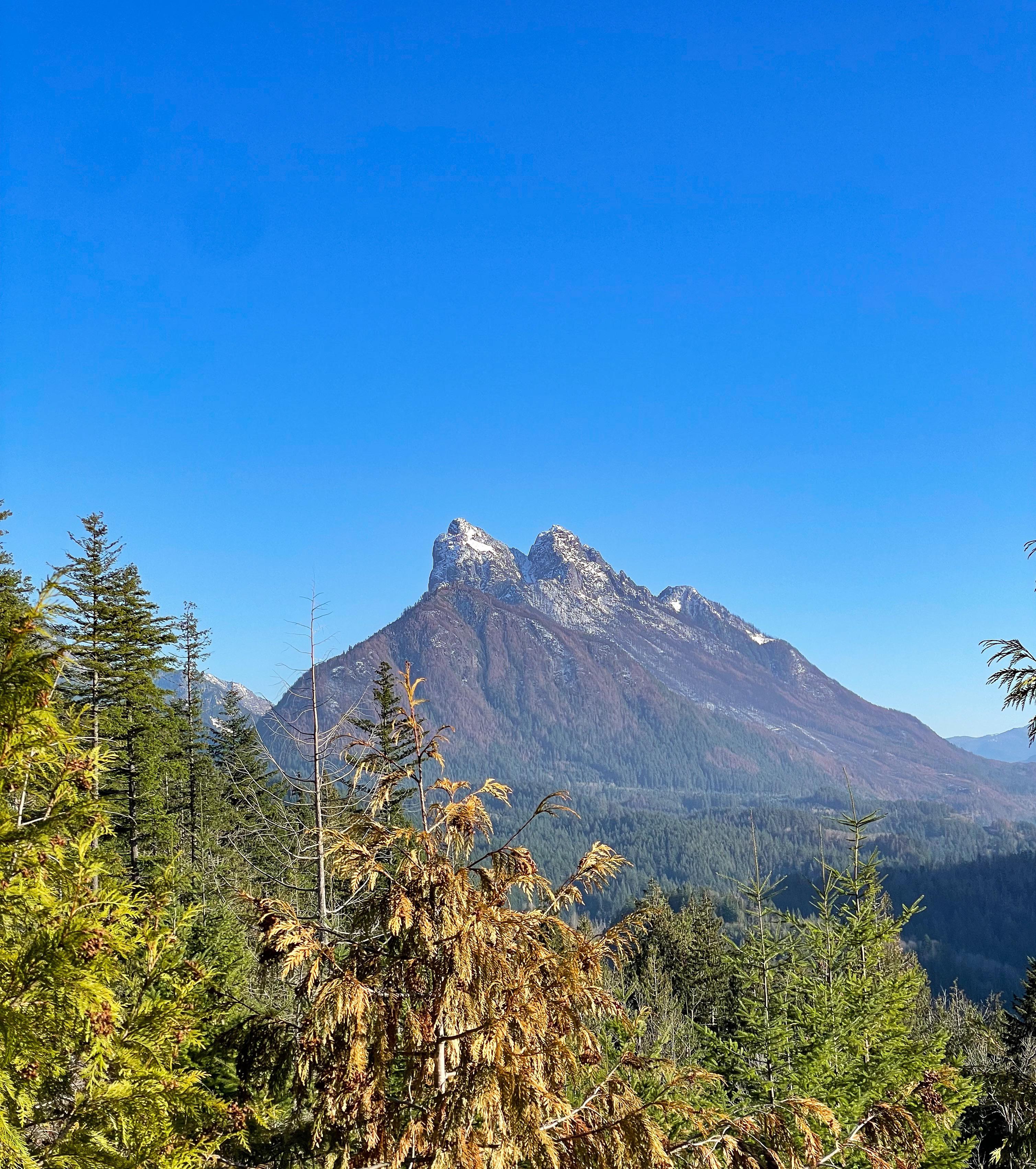
I can see the dead trees on the flanks of Baring Mountain, but fortunately a lot of trees still alive closer to the location this photo was taken from. Most of that is burned area, too, but fortunately the fire mostly stayed at lower intensity after the first two days, so the underbrush burned through there, but a lot of the trees should have survived.
There's a nice map of the burn severity here. I'm hoping to go hike up there soon to get a better sense of what this really means on the ground, but I haven't checked the current status of forest roads in the area:
At least it was mostly dangerously dry underbrush and not very many trees IIRC. As much as the smoke sucked, this was ultimately healthier for the forest and prevents larger fires in the future that do destroy entire forests, so they mostly focused on keeping it away from people
When did it burn?
Early September until the rains started a few weeks ago. I was up here over the weekend. It’s amazing to see. In some places it burned right down to the highway.
Same as Heybrook lookout trail?
No. Different start/end points, and different trails. I think WTA lists both.
No but you can get to either hike if you follow the service road along those power lines!
Also, I’m not sure where that trailhead is in relation to where I started but the entrance of this particular trail starts directly across from the bridge.
The Trailhead for the lookout is directly off HWY 2 where as heybrook ridge requires you to drive into the city of Index.
As the crow flies they're almost directly across from each other through the woods/over the ridge.
It’s no wonder I ended up over there in less than 5 miles into the hike!
Harry and the Hendersons?
The Ridgeline and lookout is in fact what you see in Harry in the Hendersons!
I literally just saw this picture on my AllTrails app. Looks beautiful!
I love that! Happy hiking 😆
[deleted] t1_iwa2zx5 wrote
The fire damage is amazing.