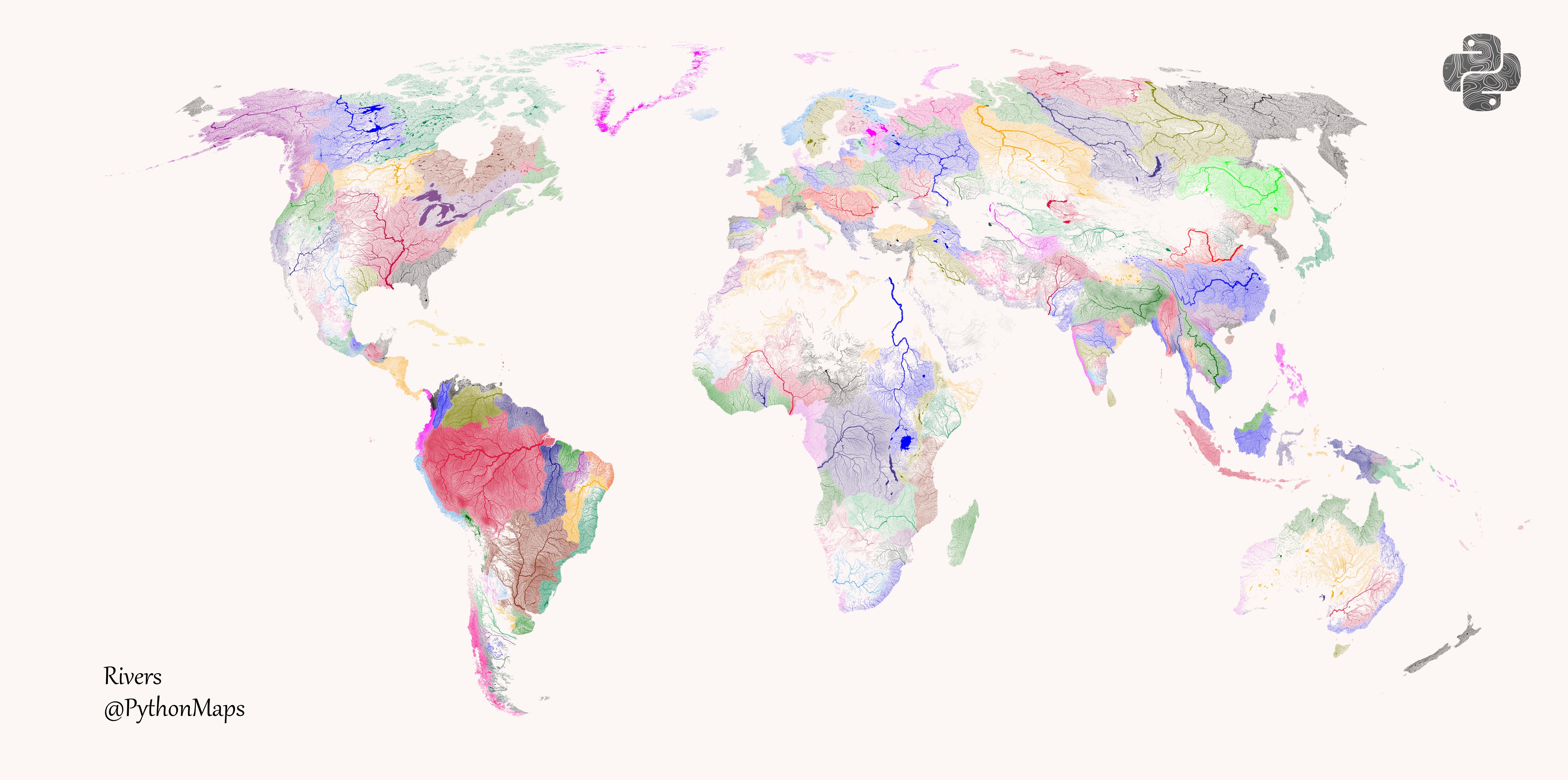
 Rivers of the World! coloured according to the major hydrological basins they are part of. [OC]
thearchiguy t1_j6tl2k9 wrote
The ones for the continents look great and maybe accurate but the ones for island nations look off and should've been of different colors. The one I'm knowledgeable of - for the Philippines, I can tell you that just the northern main island (Luzon), there should be different systems and not all of them are of the same drainage area. The map makes it look like all the rivers in an island are all connected to one another.
Boatster_McBoat t1_j6v3hqx wrote
Australia is weird af as well. Eastern seaboard is treated as one basin which is bizarre
Viewing a single comment thread. View all comments