Submitted by eon_james t3_119ziul in dataisbeautiful
Comments
ExecTankard t1_j9pu7hb wrote
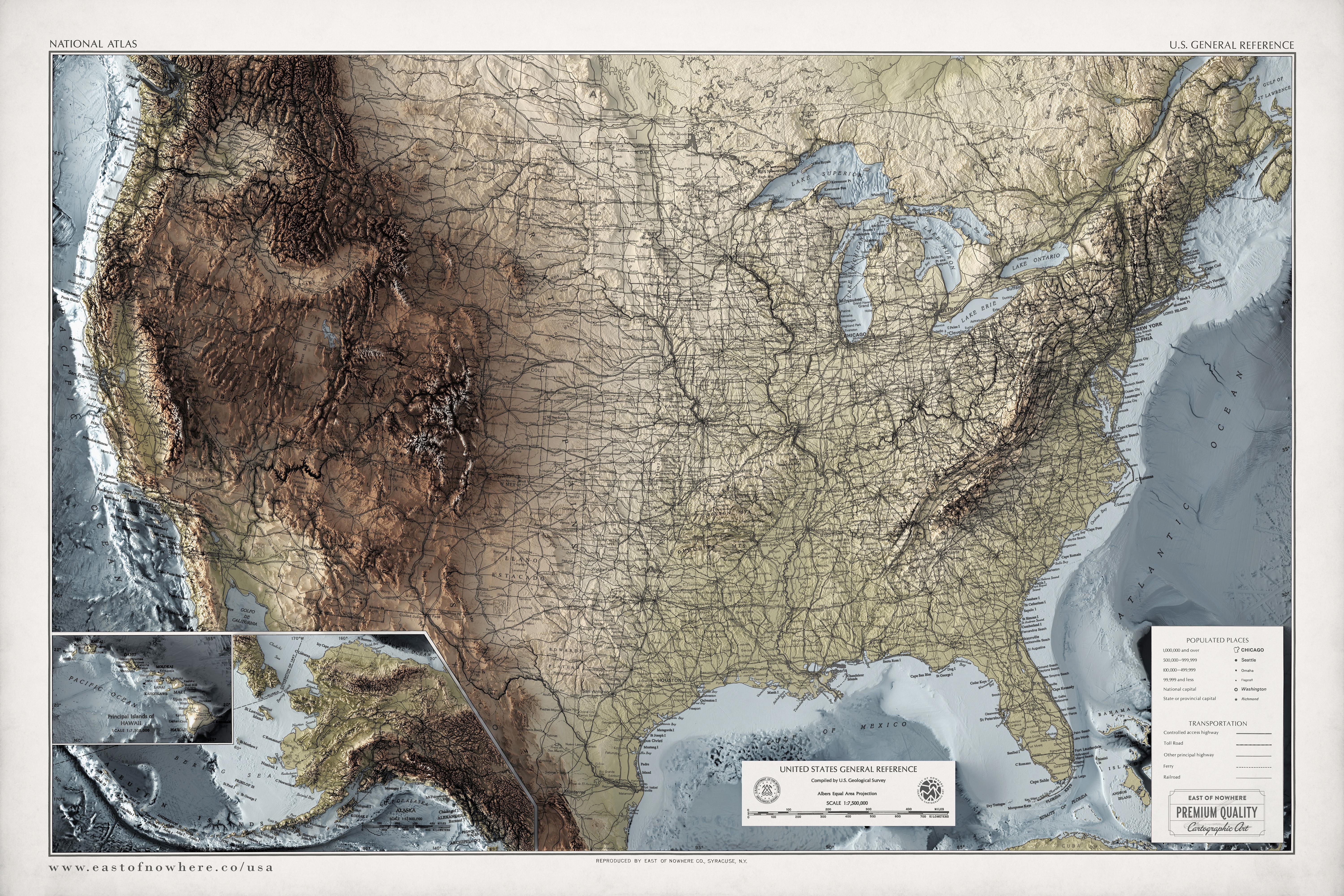
It is…but when you stand in those ‘valleys’ and see the distance between the mountains you get how vast the US is.
MuffMagician t1_j9rikli wrote
Super cool map!
Where can I buy the fully textured map? (This picture is of a flat, 2D map)
overflowingsunset t1_j9rqld2 wrote
that would be awesome to have a textured map with rugged mountains and smooth valleys and shiny resin lakes
DoNotKnowJack t1_j9ryukr wrote
"We couldn't cross the mountains, so we stopped here" - state motto of Colorado
lemonpepsiking t1_j9s5c9z wrote
That's like a quarter of my city's economy. People just not wanting to go through more mountains for the day and staying in a hotel.
Gotta love Grand Junction.
glowdirt t1_j9sky3g wrote
"Maybe if we stop here, behind all these mountains, folks will stop harassing us for all the polygamy we're doing" - territorial motto of Utah
series_hybrid t1_j9uoq7c wrote
Bunch of weaklings, watch this! -Jimmie "I'll eat anything" Donner
Sir-Viette t1_j9r9u5w wrote
But only on the left side, yeah, that’s the crimped side.
DelcoScum t1_j9oxy4h wrote
Idk the roads make it a bit too difficult to appreciate the topography. It's just a bit busy.
ProjectSunlight t1_j9p2fk4 wrote
Yeah most of the city names aren't even legible.
daedalus_was_right t1_j9pl5n2 wrote
What do you mean? My eyes suck and I can read them zooming in on a phone. I think you need an optometrist
thanks4thecache t1_j9qku0p wrote
Love this topo, but it’s waaay to busy. Highways aren’t necessary and distracts from the point of showing off the topo.
ImAWizardYo t1_j9rn43c wrote
That's just OP's title. Looks like the creator made the entire piece as "cartographic art".
farmer66 t1_j9s6pw1 wrote
Art being the keyword there
eudc t1_ja2ttld wrote
I actually like it. Roads are useful information about how busy / dense a place is and their location is influenced by topography.
ExecTankard t1_j9pujoo wrote
It shows the splits between Mountonia, Flatonia, Laketonia, Hilltonia, and Coastlinia
[deleted] t1_j9ou0hc wrote
[removed]
[deleted] t1_j9owokm wrote
[removed]
[deleted] t1_j9psqvt wrote
[removed]
[deleted] t1_j9rdl1f wrote
[removed]
Rare-Notice7417 t1_j9rf3ce wrote
Does anybody happen to know of a GIS layer for something like this?
Cuentafast123 t1_j9rwj5r wrote
You see.. This is prove the earth is flat
[deleted] t1_j9rz86o wrote
[removed]
_User15 t1_j9s1zlh wrote
Is the DFW area kind of hilly in Texas?
[deleted] t1_j9v3oq4 wrote
[removed]
gdmfr t1_j9snddo wrote
John Denver was not full of shit.
ArtistAmantiLisa t1_j9sntg5 wrote
Wow. That explains why so many other states feel flat to me.
series_hybrid t1_j9uogag wrote
When the Hudson River (New York) was connected to Lake Erie by cargo canals, it really opened up trade and made New York boom.
The Mississippi River is navigable all the way up to Minnesota, and St Louis is located where the Missouri River connects to the Mississippi.
LooksAtClouds t1_j9x0py1 wrote
Why does Houston have a big blank spot in the middle? It's the only city like this that I can see.
[deleted] t1_ja129rf wrote
[removed]

nitrolagy t1_j9p0427 wrote
Woah. The west side is so bumpy