 Compare Public Transport Network Connectivity In 10 European Countries [OC]
Submitted by TravelTime_LKB t3_123rl5v in dataisbeautiful
[deleted] t1_jdvvyb8 wrote
[deleted]
harkening t1_jdw4z9z wrote
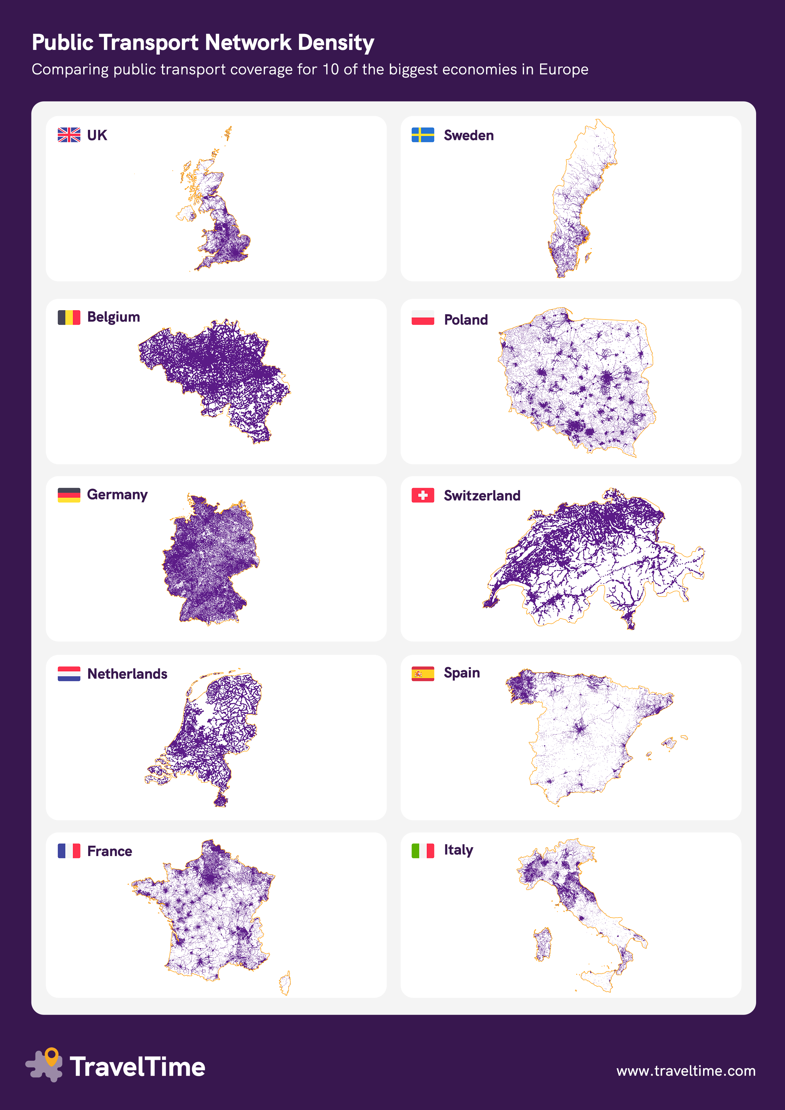
Belgium is less than a quarter the land area of England.
This shows density, but with no regard for scale. Also no accounting for where people live - i.e. population distribution and density.
r/dataismisleading
TravelTime_LKB OP t1_jdw79zp wrote
I'll hold my hands up and say for the sake of the infographic we had to use different zoom levels, I'll make sure to do it better next time!
Just did a quick screenshot using the same zoom level on our internal tool if you'd like to compare Great Britain with Belgium if anyone's interested. As a whole, I'd still say Belgium's connectivity is better, but obviously it's a smaller country so will be easier to get full coverage.
TreehouseAndSky t1_jdw8s5m wrote
Small note as a Belgian: yes we have good connectivity, but that costly affair is caused by the fact that our population is spread out over the country, as opposed to centralised in city/village centres.
Interesting number would be average walking time/distance it takes to reach a public transport stop.
harkening t1_jdwu7ef wrote
Great Britain isn't England. England is about 60% of Great Britain, which includes Scotland and Wales.
As you can see on your Belgium "zoom," the entire country can fit centered on south and western England and be comparably dense. The Midlands are also moderately dense, while only northern England, Scotland, and Wales are truly sparse. Notably for Scotland, since I looked it up quickly, the population density is 1/15 that of Belgium on average. But it's all concentrated in the areas that are connected.
TravelTime_LKB OP t1_jdx1f42 wrote
Just want to clarify why I used the term Great Britain - because the visual in the link doesn't include Northern Ireland.
I agree that Belgium's size makes it easier to have higher public transport density though!
Viewing a single comment thread. View all comments