 Compare Public Transport Network Connectivity In 10 European Countries [OC]
Submitted by TravelTime_LKB t3_123rl5v in dataisbeautiful
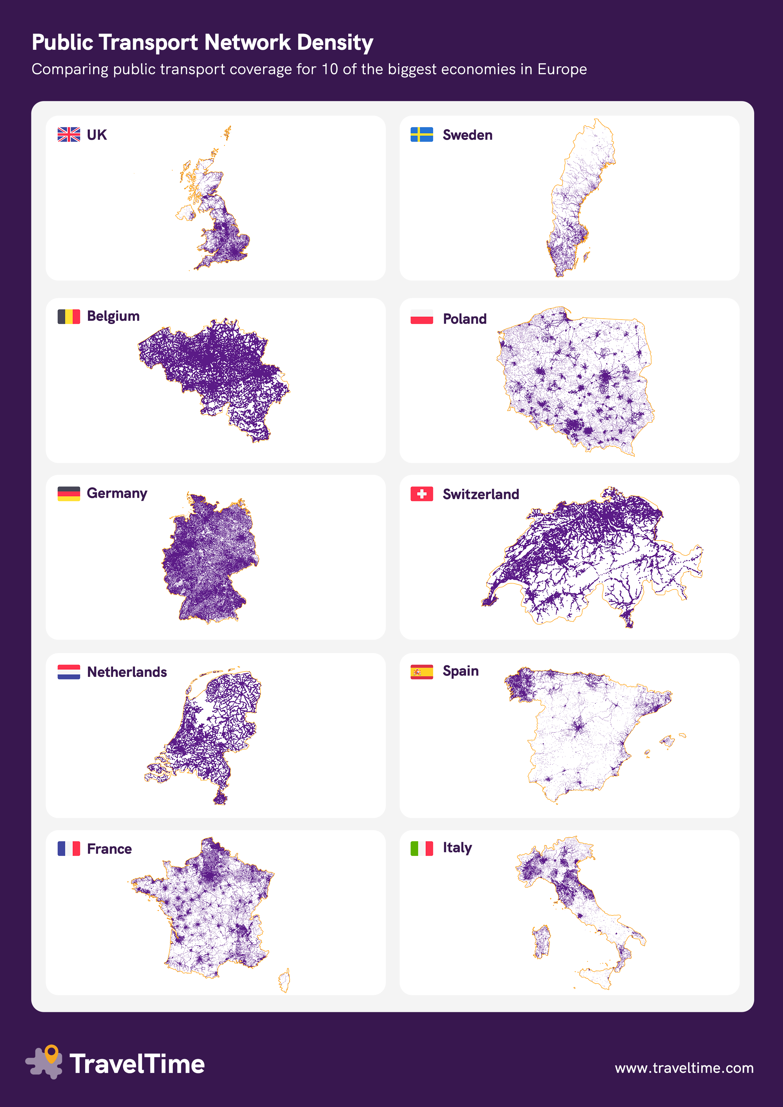
icelandichorsey t1_jdwpni6 wrote
Reply to comment by TravelTime_LKB in Compare Public Transport Network Connectivity In 10 European Countries [OC] by TravelTime_LKB
I understand what you did but I think large bodies of water should have a separate colour. Otherwise the interpretation of your map is that there's no transport on lake Zürich because the government can't be bothered to put public transport there, rather than.. It's a lake
mc_enthusiast t1_jdwvam1 wrote
Same as for mountains. You just need to be carefull what information you deduce from this graphic. If you care about service quality, this is the wrong graphic to pick.
icelandichorsey t1_jdx5acz wrote
Yeha you make a good point but I mean... Isn't that the whole point of the graphic?
mc_enthusiast t1_jdx7sav wrote
Not sure what exactly OP had in mind, but it certainly better illustrates structural differences between the countries, as well as oddities within the countries.
People already explained why Galicia in northwestern Spain looks so different (the settlements are smaller, making the population more spread out), but there are also details in other countries that make me curious. For example why Saxony has such a noticeably denser network than the rest of eastern Germany (with the exception of Berlin, of course).
panick21 t1_jdxbdf5 wrote
There is actually public transport across the lake. And its included in the same standard ticket. That should really be on the map.
icelandichorsey t1_jdz0lqa wrote
Yeah I know and it's great. I didn't want to get into that because OP didn't know/account for it
panick21 t1_je03x8o wrote
I think I have almost never used one, but I knew somebody who commuted to school across the lake.
Viewing a single comment thread. View all comments