 Compare Public Transport Network Connectivity In 10 European Countries [OC]
Submitted by TravelTime_LKB t3_123rl5v in dataisbeautiful
TheKvothe96 t1_jdzl9g7 wrote
I do not understand what does dots mean:
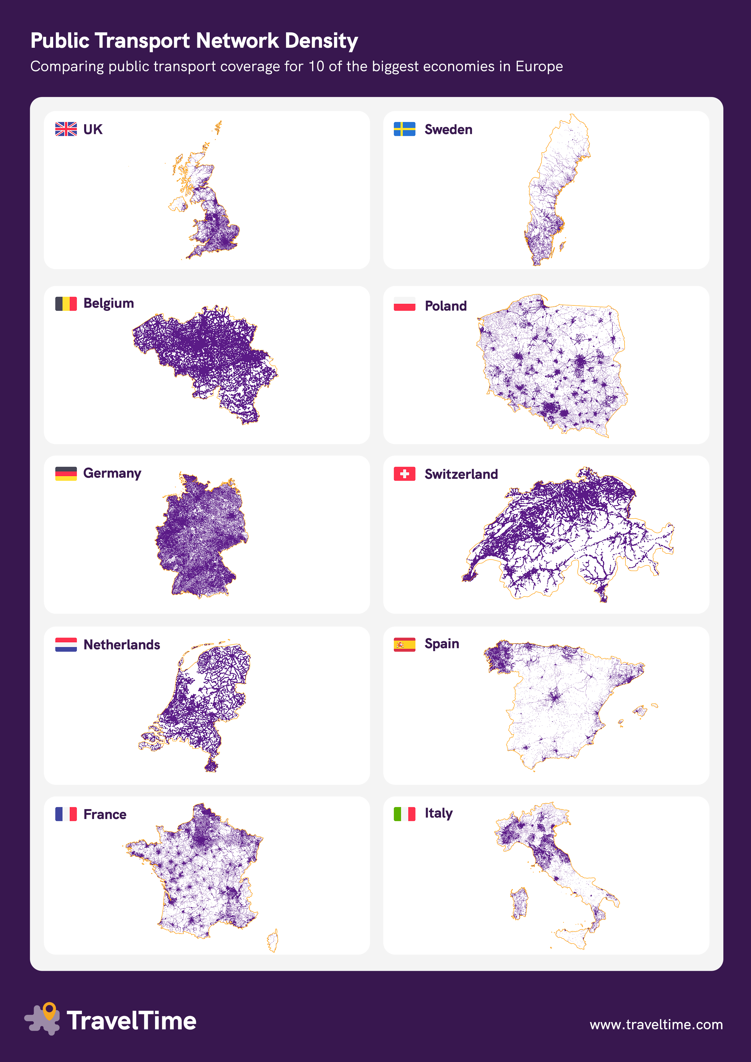
>Visualising which areas of the country are reachable by public transport. Maps with higher concentrations of purple show higher public transport connectivity.
How we built the maps:
We used our own public transport database to identify the lat/long of each public transit stop
We drew a 15 minute walking catchment area around each stop to identify the other surrounding areas with easy access
So a bus stop is a dot? Or a train station of course. But then it depends in the frequency. Maybe Germany has thousands of bus stops that pass once a day but Spain has less bus routes but more frequency. Also frequency does not mean anything if the public transport is empty.
Viewing a single comment thread. View all comments