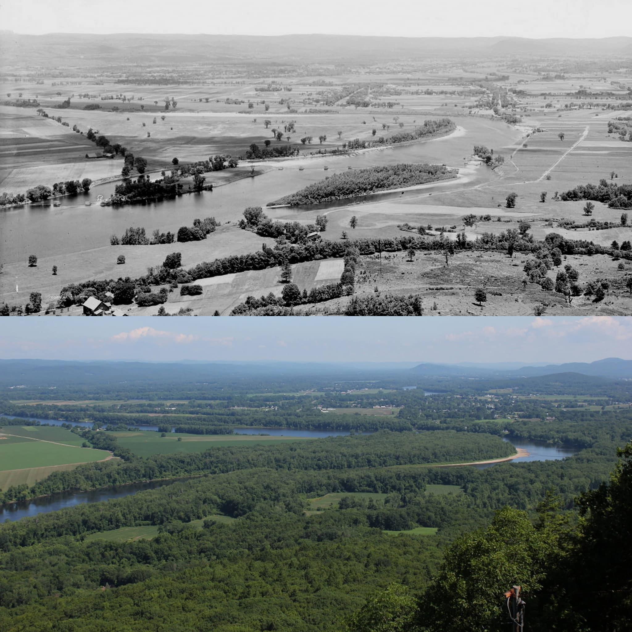
 The Connecticut River valley looking north from the summit of Mount Holyoke in Hadley, Massachusetts 1900 and 2022
Slight-Possession-61 t1_j6e42oc wrote
Is that the famous Ox Bow?
I know it’s around there…
UniWheel t1_j6ee3ow wrote
>Is that the famous Ox Bow?
No. More exactly, it is "an" oxbow, but not "the" oxbow of the area.
In the right kind of soil situations rivers do this - once there's the slightest hint of a bend (and when isn't there?), the water at the outside has to flow faster and so scours more and increases the bend creating a "meander" which can eventually become an "oxbow".
"the" oxbow was like this, but one day in 1840 with people watching the river cut right through the narrow part forming a new channel. Today that oxbow is only really connected at the southern end and is essentially a lake rather than part of the river, and so not an oxbow. (the several times diverted Mill River does drain into it though)
Left to its own devices this one would eventually do that too; though it may not be left to its own devices. If you look at the area overall, Mount Tom, Mount Holyoke, Sugarloaf, Mount Warner and Mount Toby etc are confining. But where exactly the river cuts through all that rich silty floodplain farmland has been variable over geological and even historic time.
Viewing a single comment thread. View all comments