I haven't found anything else for cities, etc. I've seen similar things for like mountain ranges though which is where I originally got my inspiration. I really enjoyed pulling this one together to I already planned on making a city version for the US and Europe, state version for the US, and other variations. It's a lot of work though so they're slow coming. Fun visualization when it all comes together though.
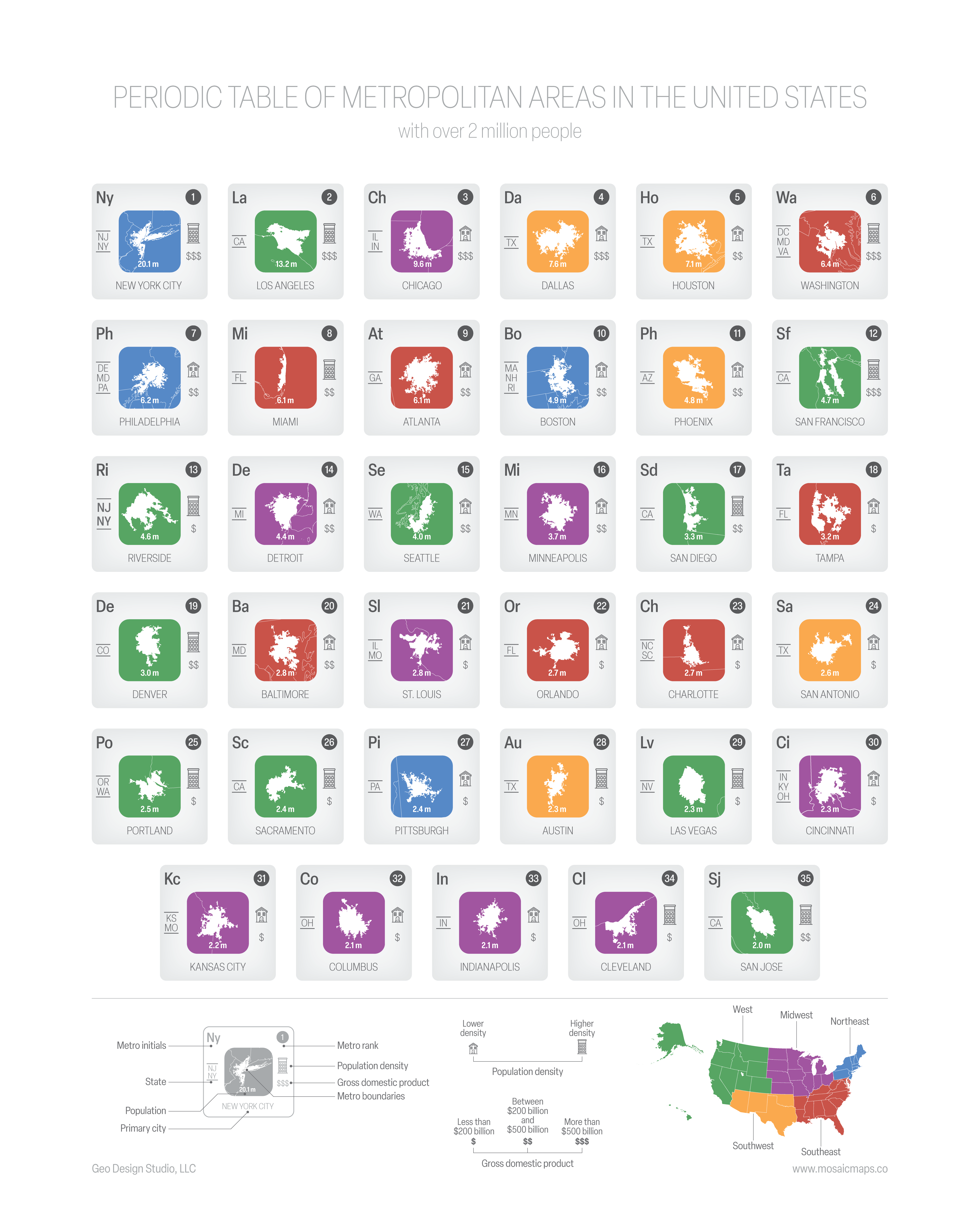 Periodic table of US metro areas over 2 million people [OC]
TheMapStack OP t1_iwrcyim wrote
Reply to comment by micknrortie in Periodic table of US metro areas over 2 million people [OC] by TheMapStack
Farts! Yes, California. Thanks for pointing that out.